LISEM Classic
LISEM
Data Manipulation
The scripting environment provides tools for manipulating geo-data.
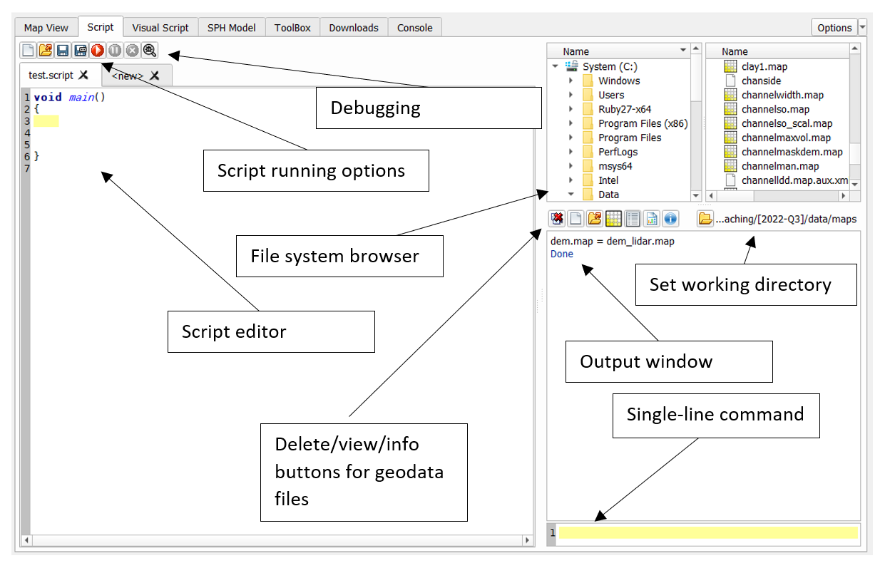
The scripting language used by LISEM is specifically aimed at manipulating geodata files. It extends the language by allowing in-line references to geo-data files from your working directory. Otherwise, it is based on the c-style language Angelscript, and features classes, functions, loops, if/else, function callbacks and many other things. The Command line allows you to perform single-line calculations. Here are some example calculations you can do in the command line
• dem.tif = dem.asc
Loads a map called dem (in asc format) and saves it to GeoTiff format.
• slope.map = Slope(dem.map)
Calculates the Slope of a map.
• calc.tif = dem.tif + slope.map^2.0 + sin(atan(sqrt(dem.map)))
Compound calculations with differing map formats. Note that all raster must have the same number of rows and columns.
• flux.map = Accuflux(ldd.map,Slope.map)
More complex geo-spatial algorithms such as flux accumulation
• dem_warped.tif = RasterWarp(dem.map,GeoProjectionFromESPG(3350))
Warping using the GDAL libraries.
• AddViewLayer(dem.asc)
Add a layer to the mapviewer.
• layers.tif = {dem.map,slope.map,WindowAverage(flux.map,100))
Use curly brackets to save a list of raster to a multi-band file.
• layer.map = layers.tif[0] + layer.tif[1]
Use square brackets to use a specific band of a multi-band raster file
• lines.shp = LineDetect(Slope(dem.map))
Detect linear features in terrain, and store them as a shapefile.
• bridges.shp = rivers.shp | roads.shp
Logical operators for shapefiles. This finds the intersection between rivers and roads.
• test.tbl[3] = test.tbl[0] + test.tbl[1] * test.tbl[2]
Table objects also support operators. The type of the table determines what operators do.
• Print(MapAverageRed(dem.map))
Print a number to the output window. The Map…Red functions act to reduce a map to a single number.
• test.tif += 100
Collapsed operators applied directly to a file.
• test.tif += dem.map
Collapsed operators applied directly to a file.
Some notes on these examples: • The syntax here differs from the scripting language in the sense that no main() function is needed. Additionally, there is no need to put the semicolon (;) at the end of the line. • The full scripting language is available. Keep in mind that for most calculations, the number of rows and columns for each map must be equal.